
Surveying, Site Verification & GPR Mapping
Precision Above and Belove Groung
At Nine Engineering, we believe that reliable data is the foundation of every safe and successful project. Our integrated approach to Surveying, Site Verification, and Ground Penetrating Radar (GPR) Mapping provides our clients with the clarity needed for confident decision-making during excavation, design validation, and infrastructure development. Whether you're detecting utilities or preparing for civil works, our methods minimize risk and ensure precision from planning to execution.
Ground Penetrating Radar (GPR) Mapping
Our GPR services help detect buried utilities, voids, and structures without excavation. Nine Engineering uses advanced GPR technology to generate accurate maps of subsurface conditions, supporting safe digging and informed planning.


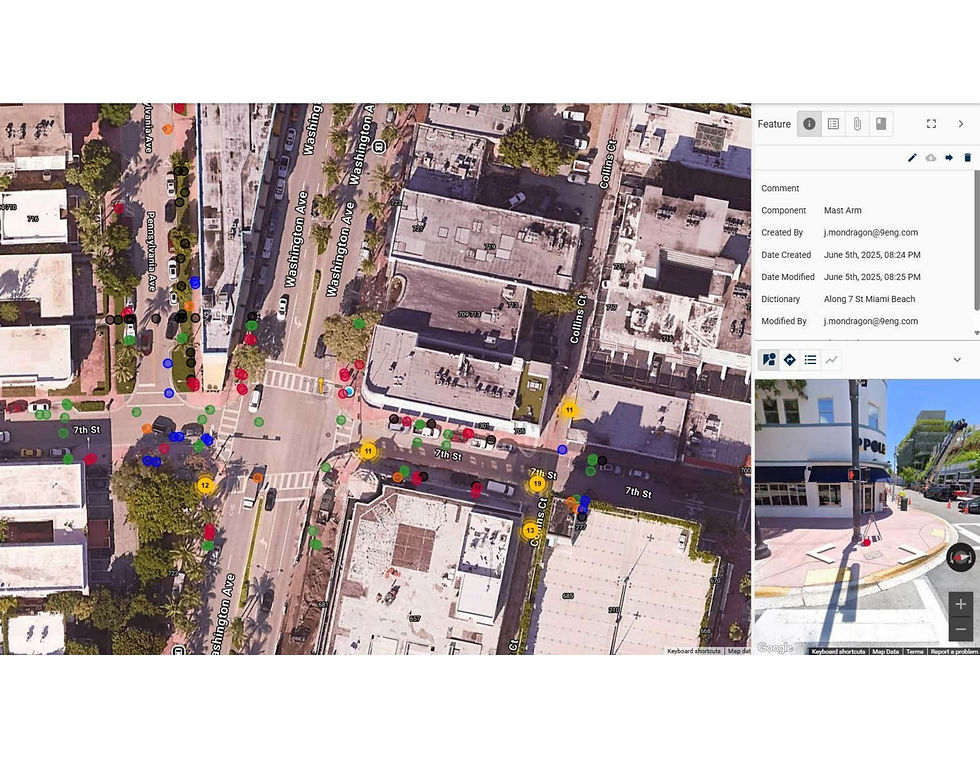
Sample of Point Man Aerial
Using drone-assisted data from Point Man systems, we enhance field insights with aerial perspectives. This service improves accuracy in utility mapping and provides valuable visual documentation for project stakeholders.
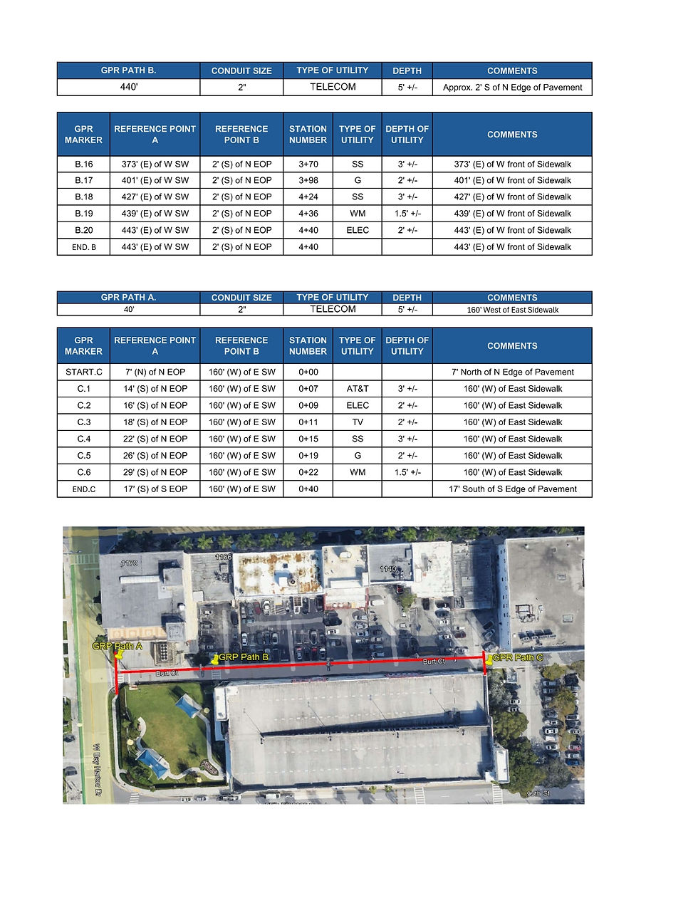
GPR Reports: Structure and Interpretation
Nine Engineering delivers clear, actionable GPR reports. We interpret complex subsurface data and structure it into user-friendly formats, enabling our clients to make fast, confident decisions on field activities.


Field Documentation and Reporting
Our crews provide complete, real-time documentation of utility work performed in the field. From daily reports to visual records, Nine Engineering ensures accountability and clear communication throughout every project.